CASE STUDY
INTRODUCTION
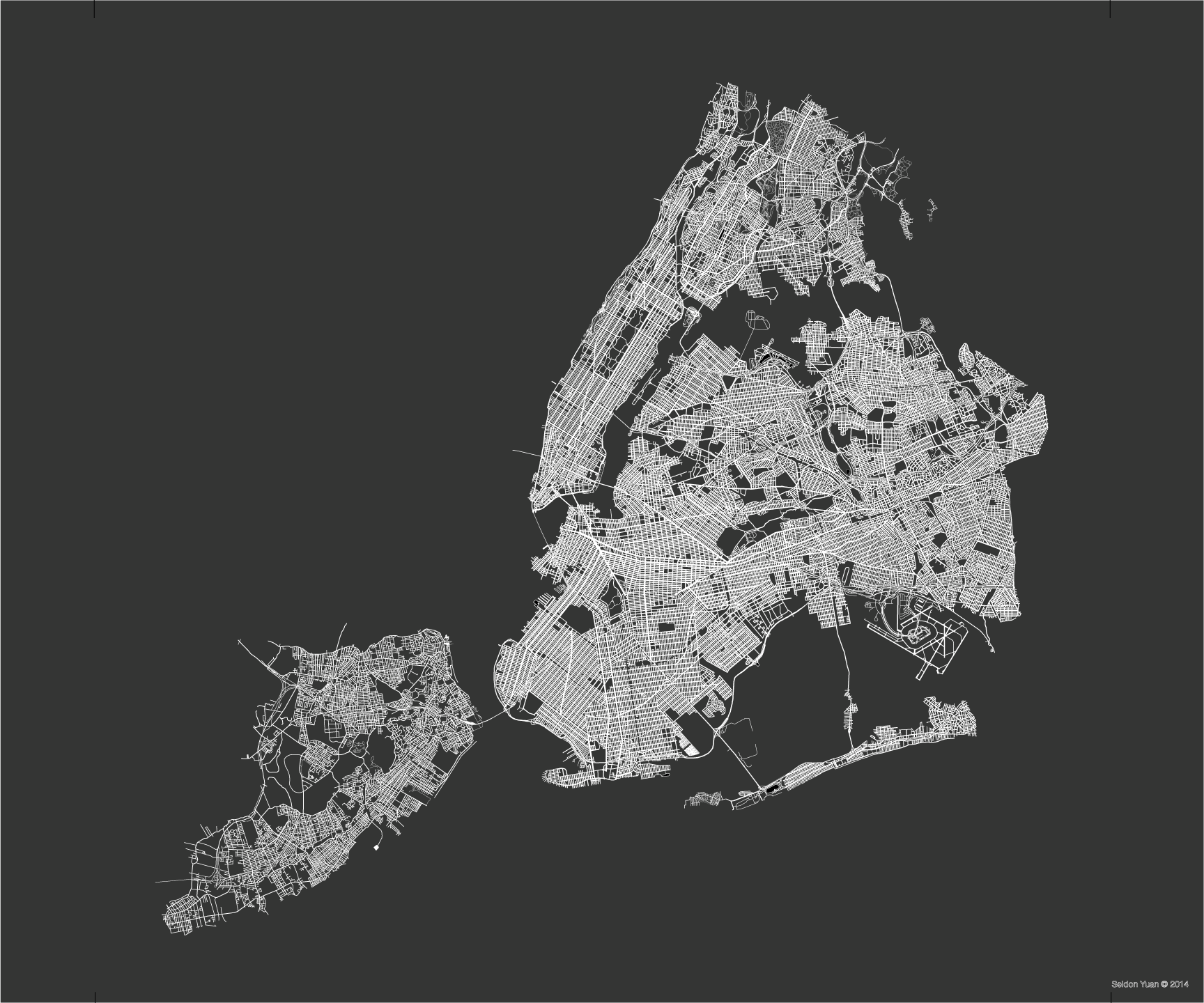
Wondering why the grid the of New York City was so broken, I researched to learn that New York City was composed of small villages with their own street grid that eventually grew to meet neighboring village grids. As an art project, I decided to make a visual book that gave a purely graphic single page holistic history of New York City where one could begin to see urbanization, growth, and migrations and their interrelationships.
DEVELOPMENT
First I scanned in a map (this was in 1999) page by page and then reassembled it in Photoshop. Then I traced every single street of the five boroughs as vector lines (for scalability and file size) and separated each borough into its own layer, and then separated each borough’s greenery, side streets, and main streets into their own respective layers. However, I never noted the land mass as I believe the streets are the arteries and veins that define the heart of the city.
PRODUCT VARIATIONS – FINE ART PRINTS
When the entire tracing was complete, I created and sold maps of each borough as art works where each borough is at the same scale relative to the others.


PRODUCT VARIATIONS – BOOK
The next phase was to create the pages/plates for a book.


The book has a translucent layer that overlays red circles of initial settlement and major development by foreigners, which begins to map the growth of this city. Underneath are layers of transparent pages noting major streets, side streets, and greenery that together form all the streets of the borough. This visual lends itself to a better and more holistic view of the city and its maturation than merely data points or various maps and text/history. Eventually, I plan to overlay additional information such as subway lines and ethnic migrations in order to allow greater visualization that could begin to point to possible cause and effects.
I made two variations of prototypes of the book.


